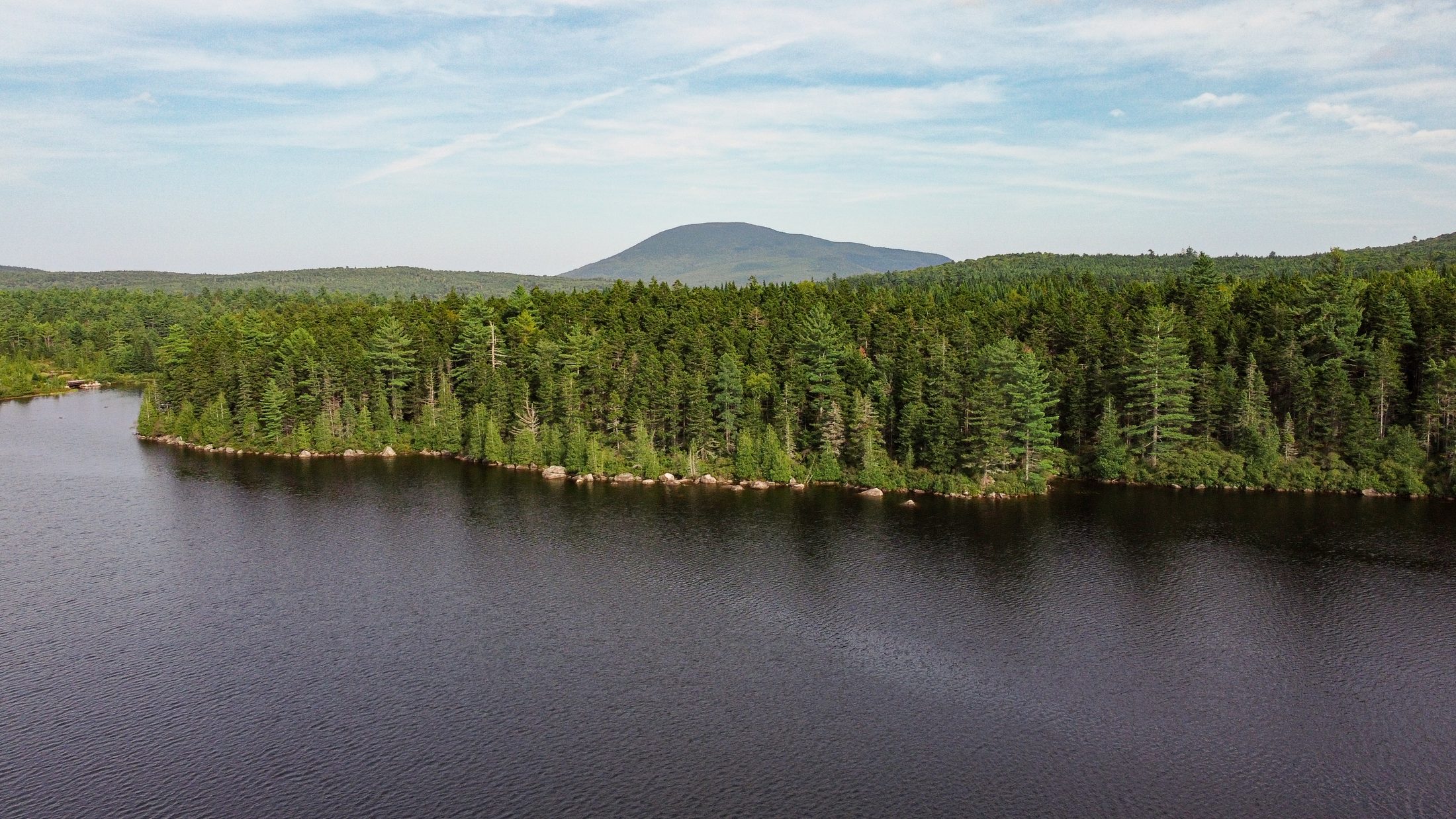
Beaver Falls Forestry Project
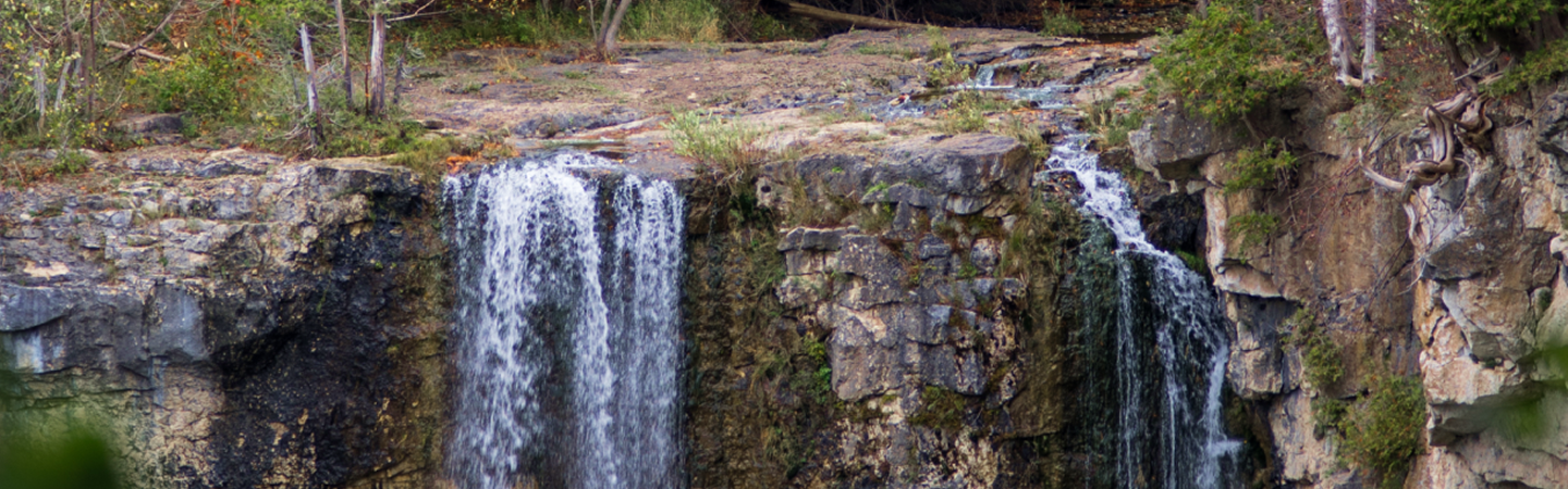
Protecting Ontario forestland to secure long-term carbon storage and habitat.
The Beaver Falls Forestry Project is an Improved Forest Management (IFM) initiative spanning two properties outside Sault Ste. Marie, Ontario — the Duncan Jarvis and Deroche tracts, totaling nearly 17,000 hectares. The land was historically logged for white pine and yellow birch and later managed under high-intensity harvest practices. Beaver Falls Forestry purchased both properties in 2021 to shift toward sustainable, long-term forest management.
The project's baseline reflects the harvest regime the property would likely follow absent a carbon project — modeled on regional shelterwood and single-tree selection cuts common to the Algoma region. By maintaining the land as protected forest instead, the project generates both conservation credits (avoided emissions from harvest) and removal credits (ongoing carbon sequestration through tree growth), registered under the American Carbon Registry
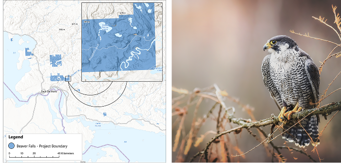
Beyond carbon impact, the property lies within the Garden River and Goulais River watersheds, supporting habitat for peregrine falcon, Lake Sturgeon, and Wood Turtle, along with cold-water fisheries feeding into Lake Superior. The project also sustains local recreation and community economic activity, including access to the Hiawatha Highlands trail network and the Sault Trailblazers snowmobiling community.

Additionality
The Beaver Falls IFM project is located outside Sault Ste. Marie, ON and is comprised of two separate properties covering a total area of 16,997 hectares. The Duncan Jarvis property covers an area of 5,983 hectares and the Deroche property covers an area of 10,994 hectares. Previous companies managed the property since the 1980s for commercial forestry purposes. The property's forest composition is dominated by northern hardwoods (Sugar Maple, Yellow Birch, Red Maple) with subsets of lowland softwoods (Spruce, Fir, Cedar, Hemlock). Beaver Falls Forestry purchased both tracts in 2021 and contracted with Prentiss and Carlisle, a forestry services provider who are experts in commercial harvest operations and management. Historically, the property was heavily logged for white pine and yellow birch during the mid‑19th to early 20th centuries, with one area also mined for silver and other minerals, leaving behind scattered remnants such as old tires, cables, chainsaw marks on trees, and abandoned mine shafts. By the mid‑1990s, strong hardwood pulp markets and the absence of sustainability requirements on private lands led the previous landowner to make unsustainable management decisions such as high grading, overharvesting, shortened cutting cycles, and neglect of riparian zones, impacts that are still visible on the property today and reflect broader pressures on private forests across the Algoma region. The Beaver Falls properties were purchased for their operability, merchantable land base, and access to nearby markets.
The landowner enrolled in a carbon project to contribute to climate action, improve land stewardship, enhance environmental quality, and build long-term financial support for conservation. Revenue from carbon credits replaces income formerly generated through timber harvests, helping cover the costs of forest health, road, and trail maintenance. In the absence of a carbon project, the company would have maintained or increased historic harvest levels, which focuses on maximizing revenues for their shareholders. The company partnered with Anew to establish an improved forest management carbon project to generate a new stream of revenue for the property.
Just minutes away, Hiawatha Highlands offers 65 km of renowned mountain biking trails, and the property's owner is open to providing additional trail access and creating exciting opportunities to expand an already thriving network. In winter, the property proudly supports the Sault Trailblazers snowmobiling community, adding even more recreational appeal.
These year‑round activities do not just attract visitors, they fuel the local economy, boosting nearby businesses as adventurers spend on lodging, dining, and services. It is outdoor recreation with meaningful community impact.
Baseline Description
The baseline scenario represents a harvest regime that could have happened in the project area if the property was not enrolled in a forest carbon project. The baseline targeted maximizing net present value of a 6% discount rate, as prescribed by the methodology. Common silvicultural practices under the baseline scenario include shelterwood cuts and single tree selection cuts, where merchantable timber is cut upon the stand reaching a specific basal area threshold, with shelterwood cuts resulting in no residual overstory trees. This type of management is common
throughout the region and would be the financially preferred harvest pattern to maximize revenue.
Regional Harvest Activities
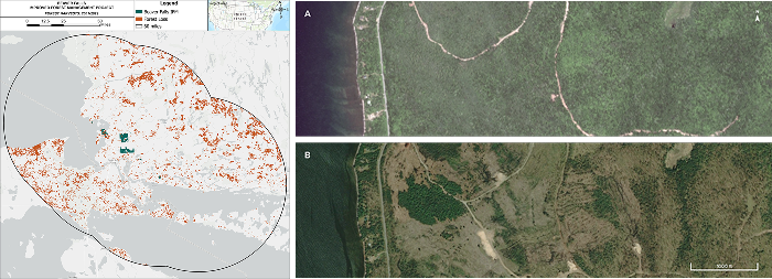
A conservative baseline scenario considers not only what a landowner could do, but what a landowner plausibly would do in the absence of the harvest limitations associated with a carbon project. In the following map, Anew demonstrates actual recent harvests in the project area’s region. This data speaks to the strength of local timber markets and common management practices on forested properties of comparable size and ownership type—an integral piece to inform the accuracy and viability of assumptions in the baseline scenario.
Harvest Comparison
All harvests/forest losses larger than 5 acres that happened between 2001 and 2022 within a 60 mile radius from the project area are depicted in orange, showing the very real pressures on forests in the area. The carbon project ensures sustainable management on the project area for 40 years, twice as long as the period depicted above.
Ecological Highlight
A conservative baseline scenario considers not only what a landowner could do, but what a landowner plausibly would do in the absence of the harvest limitations associated with a carbon project. In the following map, Anew demonstrates actual recent harvests in the project area’s region. This data speaks to the strength of local timber markets and common management practices on forested properties of comparable size and ownership type—an integral piece to inform the accuracy and viability of assumptions in the baseline scenario.
Project Impacts
Sustainable Development Goals in action
A universal blueprint for a better world—Anew is helping deliver on the United Nations global vision for social, economic, and environmental sustainability.

Clean Water and Sanitation
The Anew – Cassidy Forestry Project plays a critical role in preserving vital water resources that support aquatic species, recreational activities, and provide downstream drinking water for local populations. The project area encompasses 24 wild brook trout ponds and 15 heritage ponds and streams, which flow into the Penobscot and Pleasant Rivers. The West Branch of the Penobscot River, which flows through the property, is an essential waterway for many of the downstream communities, including Brewer and Bangor, Maine.
Additionally, the township of TAR11 WELS, located within the project's boundaries, is distinguished for its concentration of heritage wild trout-supporting ponds that have never been stocked. By implementing reduced harvesting and continued sustainable management practices through the carbon project, Cassidy Timberlands is taking significant steps to minimize the impact of forestry operations on these sensitive water resources.
These practices help maintain the integrity of aquatic habitats by protecting water quality, regulating stream temperatures, and reducing sedimentation. Furthermore, the diverse forest structures created through careful management enhance the surrounding watershed, ensuring a healthier and more resilient environment for both aquatic wildlife and the communities that depend on these waterways for clean drinking water.

Climate Action

Life on Land

How does IFM generate both removals andconservation credits?
Conservation Credits
Conservation credits account for climate benefit coming from the protection of the project area. Emissions that would have been released if the land was instead harvested in the absence of the project are quantified. Many of the co-benefits associated with forestry projects are inherently linked to the preservation of existing forest stands.
Removal Credits
As the newly protected trees grow, carbon is pulled from the atmosphere and sequestered in the trees’ wood material through the most proven direct air capture technology on the planet, photosynthesis.